Streets aren't unsafe
by accident.
They're mistimed.
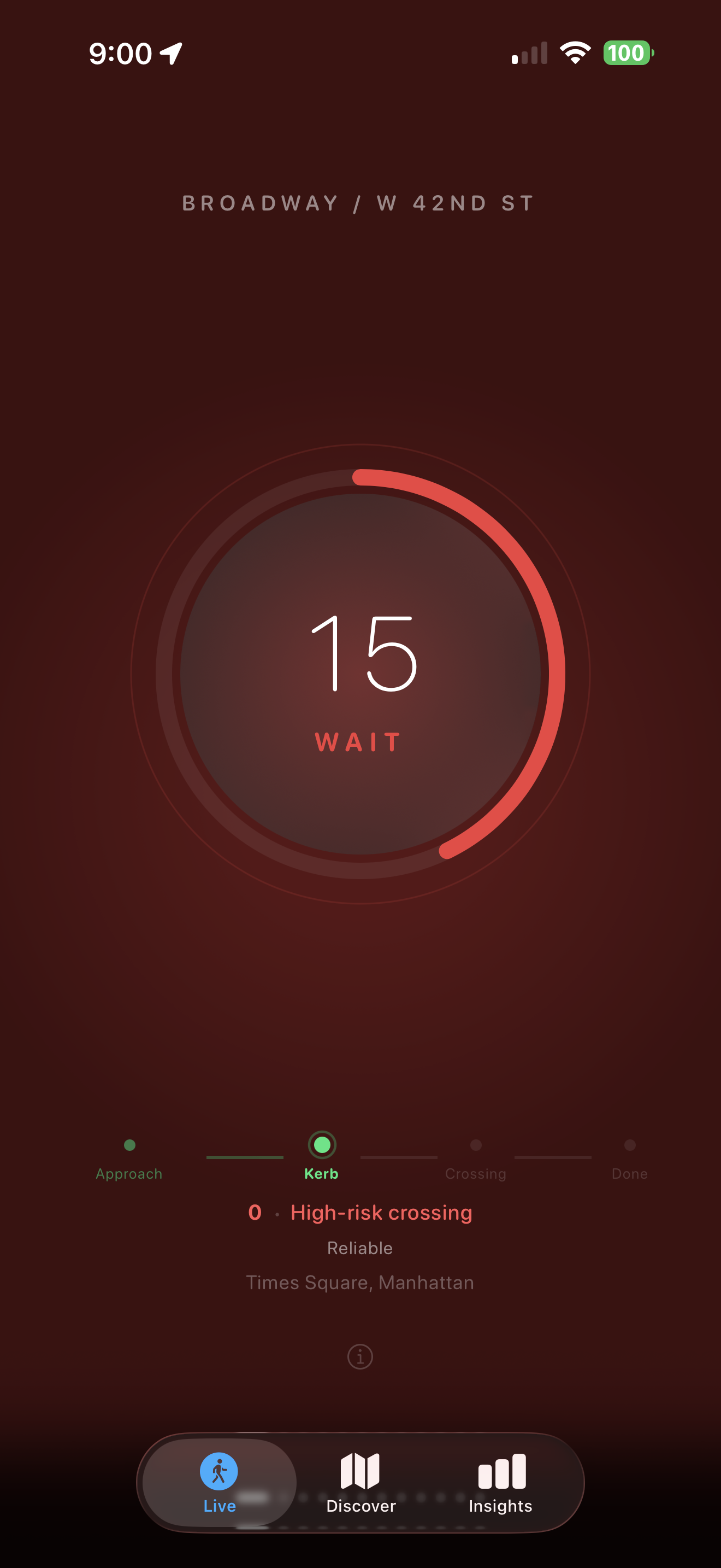
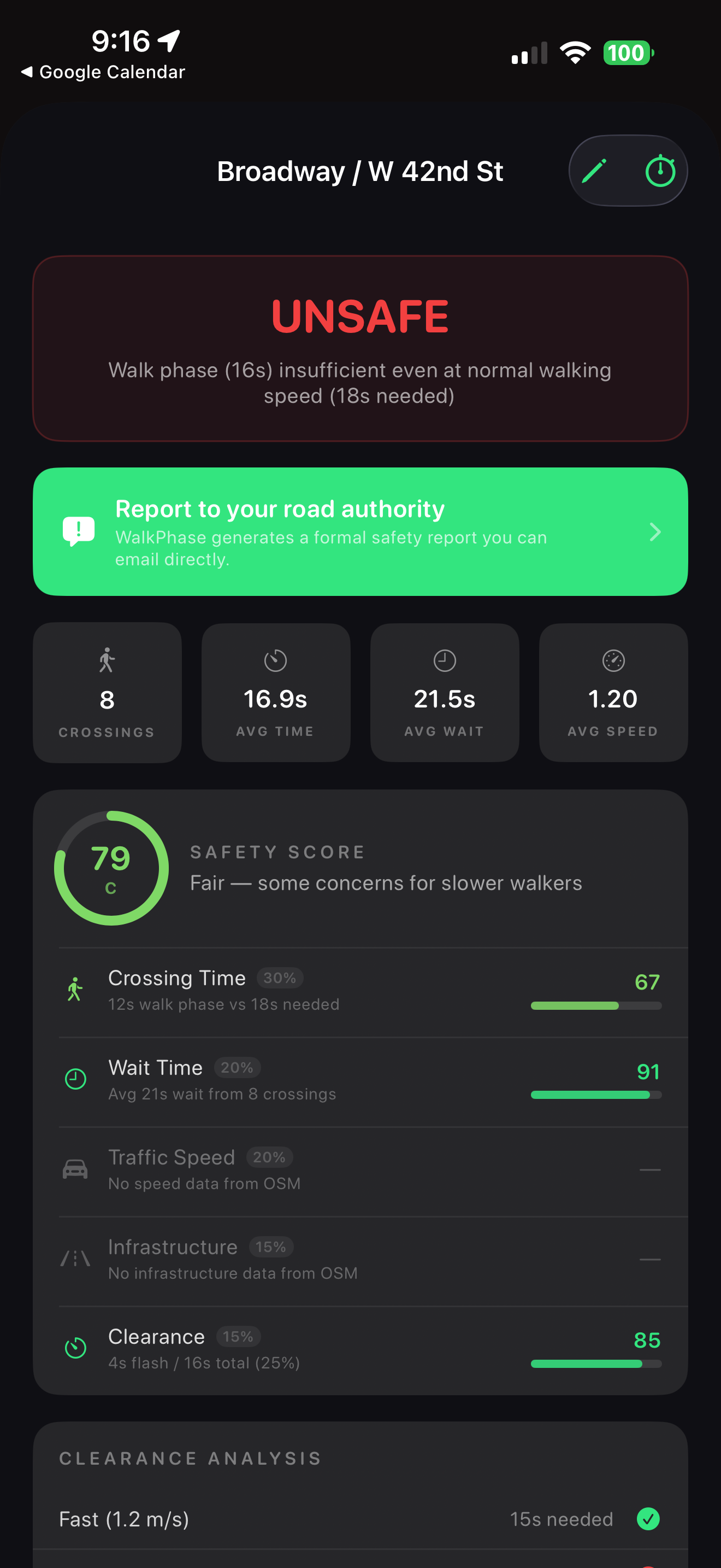
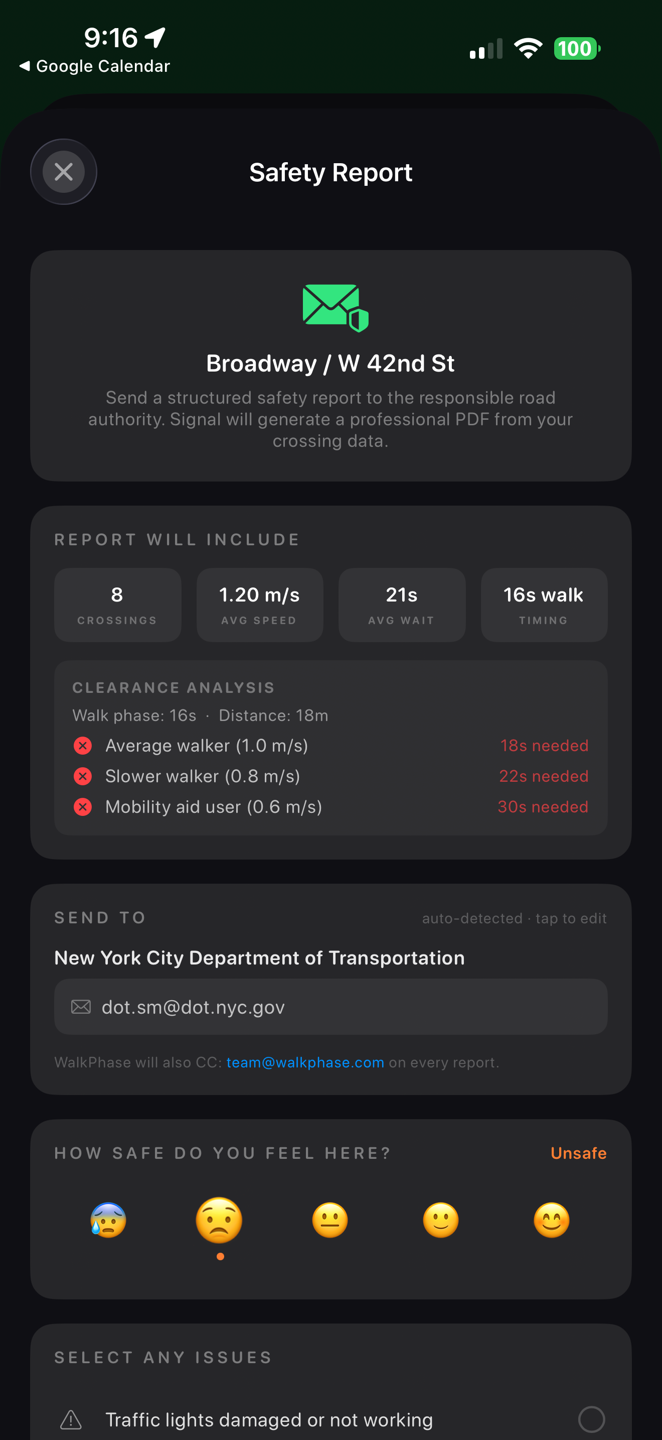
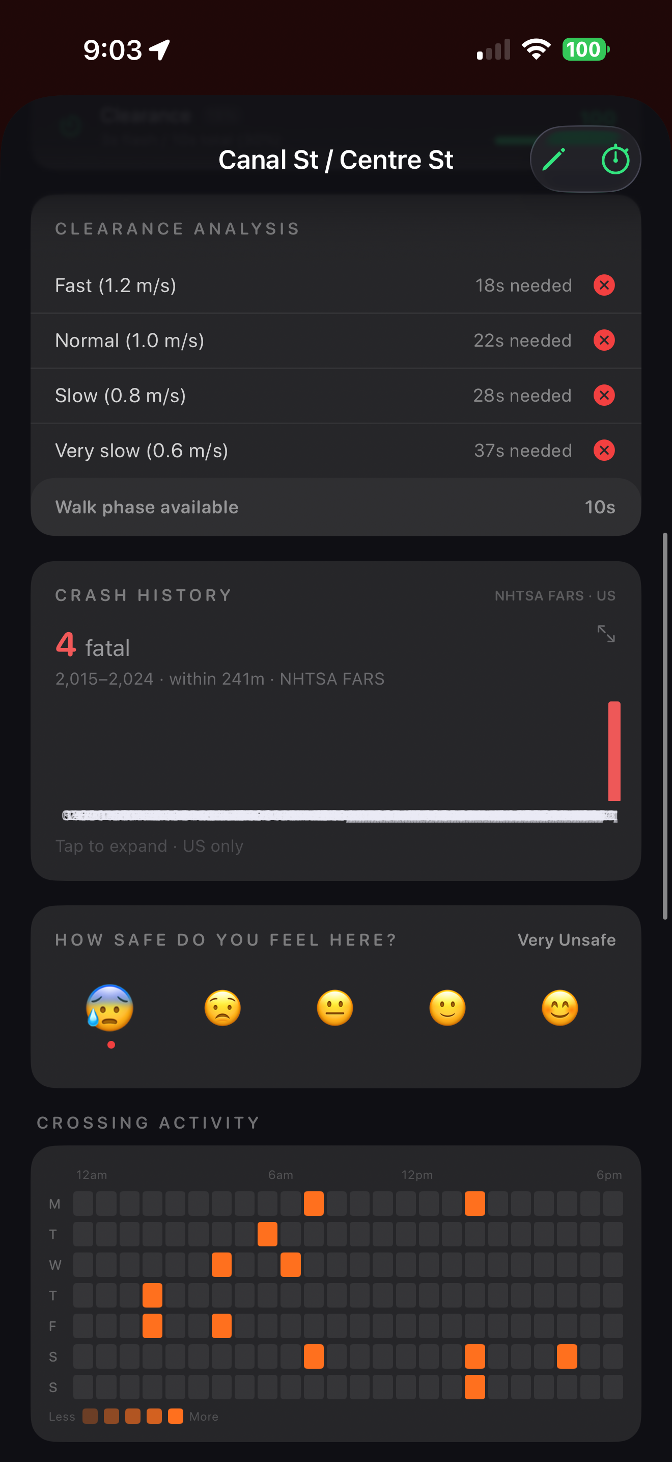
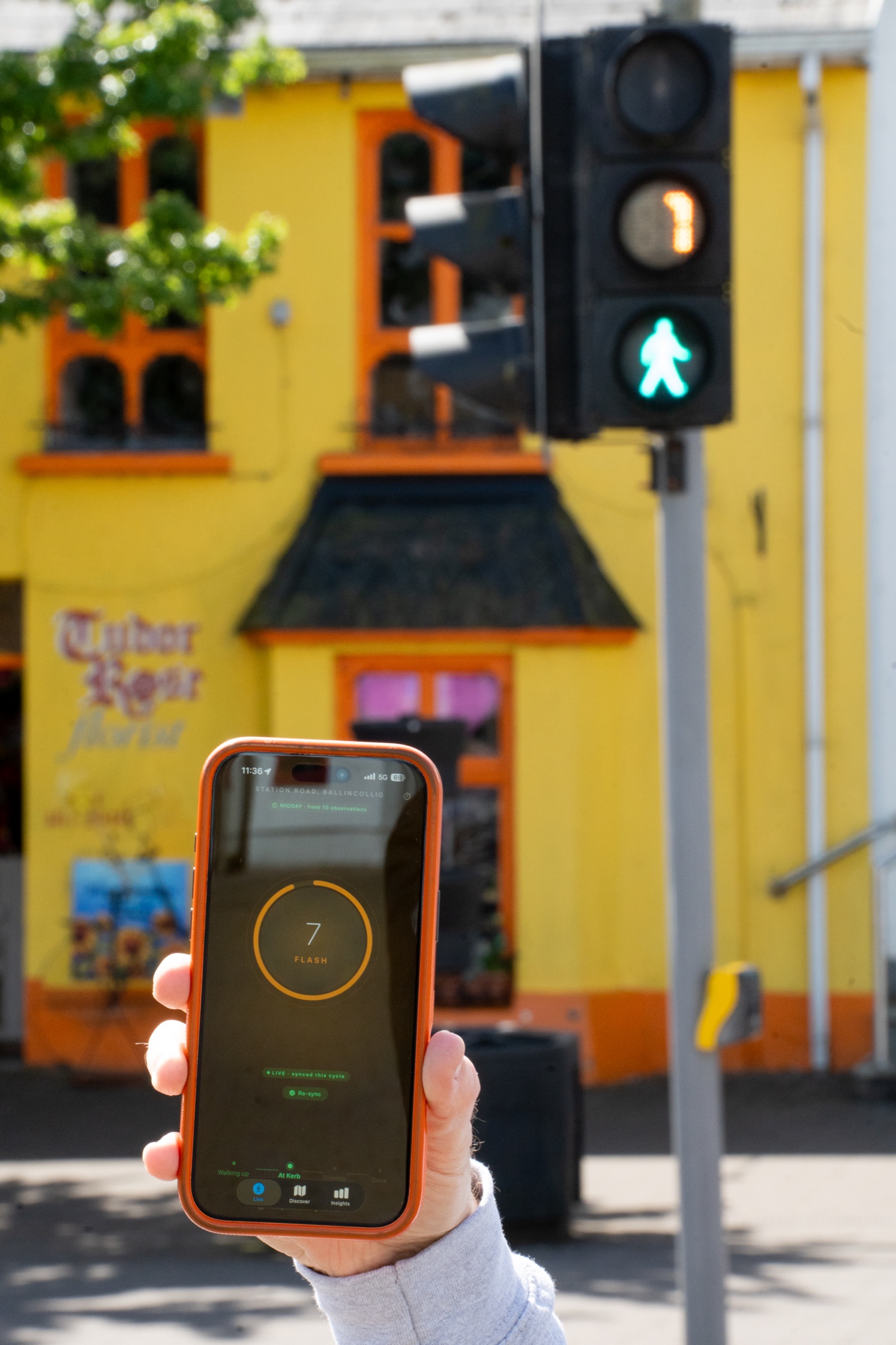
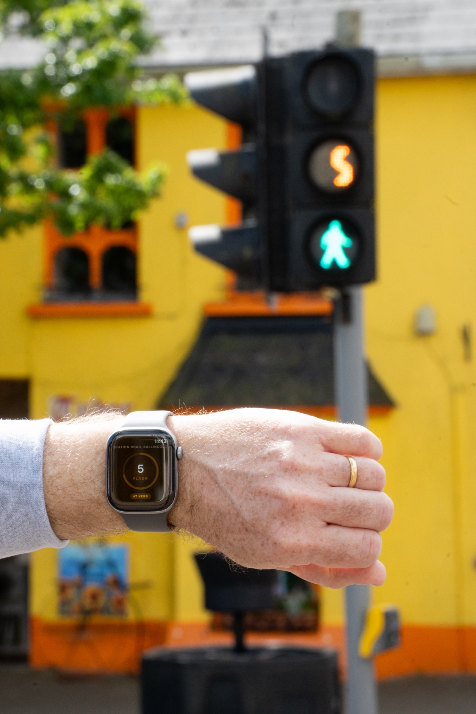
Traffic signals assume everyone walks at 1.2 m/s. Many don't.
WalkPhase measures the gap — and shows how to fix it.